Home > Blog > Weather Today
Weather Today – January 23, 2017 | Tail-End of Cold Front continues to dump rains
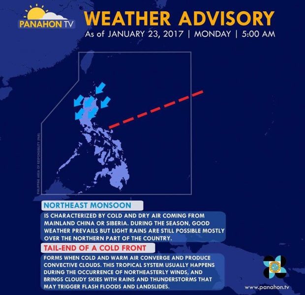
According to PAGASA, two weather systems still prevail in the Philippine Area of Responsibility today. As the Tail-End of a Cold Front affects the eastern section of Southern Luzon, the Northeast Monsoon or Amihan dominates Northern and Central Luzon.
The Cold Front is an area in the atmosphere where masses of warm and cold air converge, resulting in thunderstorms. Ordinarily, the axis of the Cold Front is in level with Taiwan or Japan. The only part that affects the Philippines is its tail end or extension. The Amihan, characterized by cold and dry air coming from Mainland China, is responsible for lower temperatures.

Ready your umbrellas because cloudy skies with light to moderate rains and isolated thunderstorms are expected in Metro Manila, Bicol, Davao, Aurora, Rizal, Laguna, Quezon and Samar.
In the Cagayan Valley Region, Cordillera and the rest of Central Luzon, cloudy skies with light rains will prevail, while partly cloudy to cloudy skies with isolated light rains are expected in the rest of Luzon.
For the remaining parts of Visayas and Mindanao, partly cloudy to cloudy skies with isolated rain showers or thunderstorms will be experienced.
Here’s the weather forecast in the next three days:
Gale warning remains over Northern Luzon, and the eastern seaboards of Central Luzon, Southern Luzon and Visayas. Fishing boats and other small seacraft are advised not to venture out in these areas while larger sea vessels are alerted against big waves.

Latest Advisories
