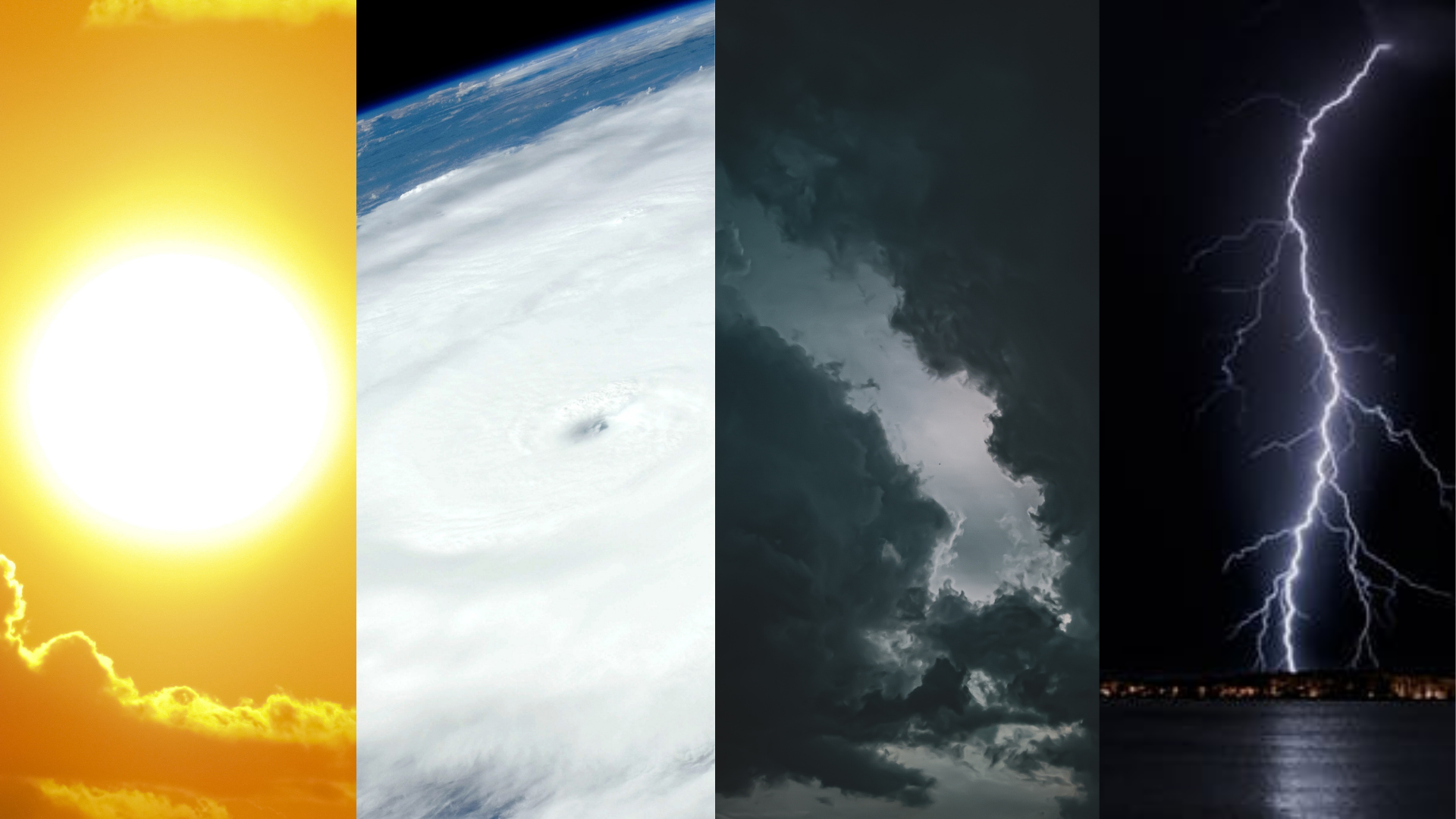
Weather forecasts are essential today as they were centuries ago. Our ancestors used observation methods to predict the weather, such as the loud croaking of frogs and the animals’ frantic scramble for shelter, believed to indicate imminent rain or stormy weather. Rain may also be preceded by a red sunrise, cloud towers on mountains, and a starless sky. The sound and sight of giant waves rolling are signs of a looming storm.
Meanwhile, the change of seasons is seen through the ripening of certain fruits. The proliferation of duhat, kaimito, langka and melon happens during the dry season, while the abundance of durian, guyabano, santol and siniguelas signifies the wet season. These observations are especially useful to farmers, sailors, and fishermen whose livelihoods are weather-based.
Fast forward to modern times, and weather forecasts are now available across all media platforms. Despite their accessibility, many are not aware of how much work is involved in coming up with reliable forecasts. According to PAGASA Weather Forecaster Aldczar Aurelio, the process requires several steps and the use of weather instruments. “We analyze weather maps (current and previous data), interpret the weather data coming from synoptic stations, monitor the images from weather satellites, analyze the outputs of numerical meteorological weather prediction, and discuss with fellow weather forecasters. It’s also important to know weather patterns or the behavior of weather systems for particular months or seasons.”
The Importance of Weather Forecasts
Because of our country’s geographical location, the Philippines is prone to natural disasters including tropical cyclones. According to PAGASA, about 20 tropical cyclones enter the Philippine Area of Responsibility, bringing with them hazards such as floods and destruction.
In October last year, Typhoon Ulysses entered the country during the pandemic, causing 67 deaths and more than P16 billion damage in agriculture and infrastructure. Though typhoons cannot be prevented, impacts can be mitigated through preparedness. According to Aurelio, weather forecasts can help in the following:
- Protecting life and property
- Helping people to dress accordingly and prepare weather essentials such as raincoats, umbrellas and sunscreen
- Serving as guides in power production and consumption. Energy production relies on weather elements such as wind speed, air pressure and air temperature.
- Helping people plan their activities
- Aiding businesses plan for transportation hazards such as thunderstorms, rains, and strong winds
- Helping people prepare for weather-related health issues such as allergies, asthma, and heat stress
- Helping communities plan for severe weather and weather hazards such as lightning, hail, flooding, and landslides
- Guiding the agricultural sector in planning for crop irrigation and protection
- Providing weather information for the tourism industry
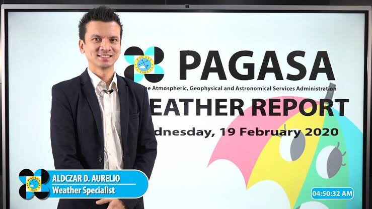 PAGASA Weather Specialist Aldczar Aurelio
Observing Weather on Your Own
Should you find yourself in a situation that hinders you from receiving weather forecasts, Aurelio suggests that observing your surroundings like what our ancestors did.

Cloud formations
Aurelio states that cloud observation is a basic foundation of meteorology. “There are three types of cloud formations. High clouds, middle clouds and low clouds,” he shares. “High clouds are associated with good weather— sunny, clear and fair. It’s ideal for outdoor activities. Middle clouds are associated with fair weather, but also with the brewing of bad weather. Low clouds are associated with bad weather—storms and rain. Cumulonimbus known as thunderstorm clouds are examples of low clouds. These low clouds are common during the rainy season.”
He also added some folk knowledge in predicting the weather, “When you see tower-like clouds, expect rain because those will bring thunderstorms. If you see a field [of clouds] on the base of clouds, it’s possible to experience a tornado.”

Stars
As to the popular belief that starless skies predict rain, Aurelio says that “Clouds that can cause severe thunderstorms cover the whole sky dome. “ But if a few stars are visible, then rain is still possible.
Given the ever-changing weather systems, forecasts are never 100% accurate. But the constant monitoring of weather forecasts and a keen awareness of our surroundings may boost our safety and preparedness. After all, we cannot escape the seasonal changes of our country’s weather even during a pandemic.
In December last year, the International Labor Organization (ILO) reported that over 10 million Filipinos may experience job disruption in the way of salary cuts, decreased working hours, or total job loss because of the pandemic. In the Asia-Pacific region, approximately 81 million jobs were lost in 2020, which may raise the region’s unemployment rate by over 2% from 2019.
Given the job market’s volatility, workers should to be able to quickly adjust when faced with job disruption. With lessened pay and working hours, they need to find additional sources of income. With limited job openings, sudden unemployment might require, not only changing employers, but a career shift.
But how can one shift roles? For example, if you’ve been working in law for some time, and you wish to shift to being a writer, it pays to have soft or transferable skills that allow career mobility. Specialization or the mastery of one skill may increase your marketability, but only up to a certain point. With technological advancements and global crises such as the COVID-19 pandemic, your specialized skills run the risk of being outdated, which may lead to unemployment.

Hard Skills vs Soft Skills
While hard skills comprise technical knowledge or specific training for a particular area, Psychologist Roselle G. Teodosio, owner of IntegraVita Wellness Center, defines soft skills as “interpersonal skills that shape who you are, and how you work or deal with others.” Hard skills are more teachable, while soft skills are cultivated. Teodosio adds that hard skills can be thought of as IQ (intelligence quotient) while soft skills are equivalent to EQ (emotional intelligence). “Nowadays, a lot of companies look for people who have higher EQ. Emotional intelligence is seen as something that enhances and bolsters hard skills. A lack of soft skills would hinder an employee from thinking outside the box, or imparting their knowledge.”
In her two-decade career, Karen Seno has successfully shifted across roles in TV and video production, corporate communications, and human resources (HR). As the current HR manager of a holding company, Seno believes that soft skills are vital during these challenging times. “Soft skills are key in fostering an effective and productive virtual-work environment grounded on empathy. By developing soft skills, employees are able to add value both to their professional and their personal lives. It shows their commitment to self-development beyond the technical aspects of the job they hold.”
Teodosio agrees that soft skills show a person’s capacity to grow in a company. “Since employers tend to invest in their employees, they would want to have someone on a long-term basis. Companies also look for team players. A person who can adapt to different personalities, and shows good leadership and work ethic in times of crisis represents the company and what it stands for, especially to potential clients and business partners.” Such valuable soft skills also promote job security. “If there will be downsizing, economic slowdown or even a pandemic, then the employee who has shown these skills will likely be retained than let go,” Teodosio adds.
Though both hard and soft skills are necessary and complimentary to each other, Seno believes that that the latter trumps the former. “In most cases, I would say an ideal mix would be 60% soft skills and 40% hard skills.”

Top 5 Soft Skills Employers Seek
With the pandemic affecting businesses and employment, Teodosio says the need for soft skills is more relevant than ever. “Companies are very careful in choosing the employees that will be most beneficial to them in terms of productivity and flexibility at least cost. It is to the advantage of companies to retain employees who can play a lot of roles in the company to maintain productivity while cutting back on overhead expenses.”
But pandemic or not, employees need to step up their game to cope with the ever-changing landscape of industries. According to the World Economic Forum, the top 5 skills employers are looking for are also soft skills.
- Communication
Seno shares that shifting to a virtual work setup has limited our personal interactions, yet has increased the amount of time we spend on meetings. “Effective communication can then save on time and resources, bridge gaps, and establish stronger relationships.” Teodosio follows this up with by saying that clear communication should be carried out across all levels—“may it be the big bosses or their co-workers, one on one or as a team. Effective communicators build connections inside and outside the company.”
How to improve this skill:
- Be open to feedback.
- Constantly practice getting your message across.
- Be concise and get to the point.
- Be mindful of your non-verbal communication (body language, tone of voice, facial expressions).
- Be clear with your desired action from your listener or receiver.
- Problem Solving
Problem solving demonstrates a person’s self-reliance. Seno explains, “Companies need people who are concerned not just with delivering the basics according to their job description, but who can thrive when things don’t go their way.” Teodosio agrees. “A good employee is able to stay calm and rational when problems arise. Rather than emotions, his decisions are guided by logic and common sense.”
How to improve this skill:
- Learn to identify and simplify problems.
- Collaborate with stakeholders in brainstorming possible solutions.
- Be open to changes.
- Go beyond your comfort zone.
- Analytical Skills
Seno states that analytical skills are key in gaining an in-depth understanding of a topic or issue. “This is useful for goal-setting during project planning, or for coming up with solutions for complex problems.”
How to improve this skill:
- Learn all that you can about a topic or issue.
- Be observant.
- Ask questions.
- Interact with different personalities who offer various perspectives.
- Develop a learning mindset.
- Customer Service
Communication is the foundation of excellent customer service. Though this skill in useful in building a solid clientele, Seno stresses that “A good employee treats all their stakeholders—be they internal or external—as customers.” An openness to feedback and improvement ensures quality outcomes for customer satisfaction.
How to improve this skill:
- Manage customer expectations.
- Give services a personal touch.
- Focus on solutions to achieve customer satisfaction.
- Build positive relationships.
- Leadership
“Leadership requires accountability, authenticity, and empathy. Effective leaders are like lighthouses—they give a general direction for guidance as team members navigate the rough seas,” Seno illustrates. Teodosio says that “If an employee has good leadership skills, it follows that he is able to communicate himself well to others.”
How to improve this skill:
- Take the initiative.
- Listen.
- Develop situational awareness.
- Empower or motivate others.
- Encourage honest feedback.
While these traits have always been relevant in the workplace, Teodosio says they are even more important now during the pandemic. “The pandemic has brought on feelings of isolation and anxiety, to name a few. If one cannot handle such a stress, then how will he be able to address the other stressors work can bring?”
Tips for job hunters
Job hunting may be extra challenging these times, so our experts offer these bits of advice:
Widen your network. “Do not limit yourself to one or two fields,” says Teodosio. “Instead, try to look at other fields of expertise that you find interesting. It is not the best time to be picky.”
Boost your skills. Both experts agree that now is the perfect time to expand one’s knowledge. “Explore free online classes. The additional skills will make your CV shine,” advises Teodosio.
“Creating your own ‘personal brand’ will make companies notice you. You need to focus on what is unique about you.”
Prepare for virtual interviews. Because first impressions last, small details such as your clothes, background, and even the way you sit matter.
Be patient. If you don’t find a job right away, don’t be too hard on yourself. “A lot of companies are affected by the pandemic,” Teodosio says. “So, they are quite choosy with candidates. Just be on the lookout for job openings you are interested in.”
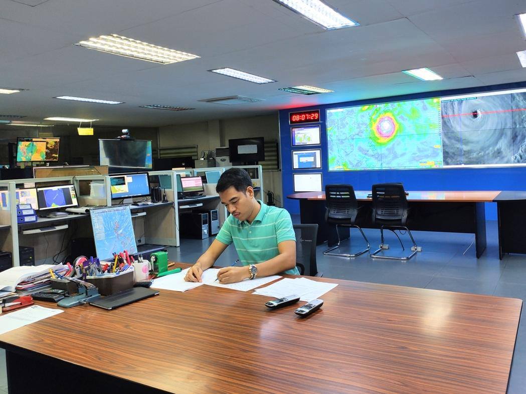
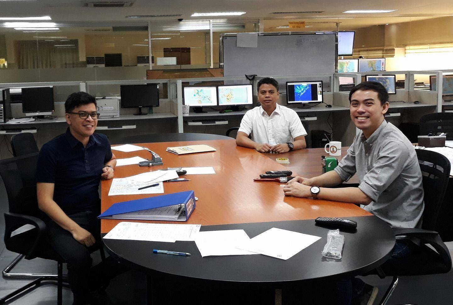
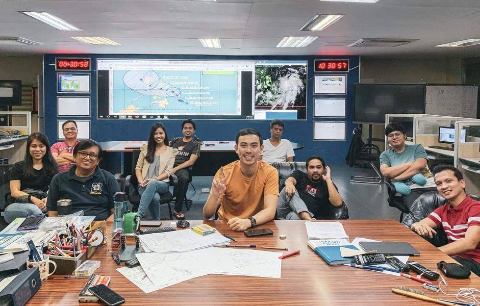
Within a month, from October 11 to November 12, a total of 8 tropical cyclones entered the Philippine Area of Responsibility—something that had kept weather forecasters from the Philippine Atmospheric, Geophysical, and Astronomical Services Administration (PAGASA) constantly on their toes. As an attached agency of the Department of Science and Technology (DOST), PAGASA is mandated to “provide protection against natural calamities. and utilize scientific knowledge as an effective instrument to ensure the safety, well-being and economic security of all the people, and for the promotion of national progress.”
Though the PAGASA team comes up with the weather forecasts and tropical cyclone warnings, viewers often see this information relayed by the TV networks’ reporters. This time, Panahon TV trains the spotlight on some of the Watchers of the Atmosphere themselves—the weather specialists that tirelessly work behind the scenes to constantly monitor all weather disturbances that pose a threat to our country.

Name: Chris Perez
Positions: Senior Weather Specialist
Immediate Supervisor, Weather Forecasting and Marine Meteorology Services Sections
Master’s Degree in Climate Change at the Australian National University in Canberra
Workshops Attended: The International Workshop for Weather Presenters in Vietnam (2015), Information and Communications Technology for Meteorological Services in Korea (2006)
How did you end up as a PAGASA weather forecaster?
After passing the Electronics and Communications Engineering Board Examinations in 2000, I worked in the private sector for 2 years. I then worked at PAGASA as a weather facilities technician, calibrating weather instruments. Then I applied for the one-year Meteorologist Training Course, which I passed. I was assigned to the Weather Forecasting Section in 2005.
What are your current duties?
Currently, I am tasked to oversee the day-to-day operations of the Weather Forecasting and Marine Meteorology Services Sections, particularly the formulation and dissemination of forecast products. Occasionally, I act as the agency’s spokesperson during inclement weather conditions.
What is your most memorable typhoon?
Super Typhoon Yolanda in 2013 because it exposed the weaknesses in our country’s disaster preparedness. It was the first time PAGASA issued a forecast while a cyclone was still outside the Philippine Area of Responsibility (PAR). I was part of the team that attended and updated the National Disaster Risk Reduction and Management Council (NDRRMC) prior to Yolanda’s entry to PAR.

Name: Ariel Rojas
Position: Weather Specialist
Master’s Degree in Meteorology at the University of the Philippines
Workshop Attended: Reinforcement of Meteorological Services in Japan (2019)
How did you end up as a PAGASA weather forecaster?
I was born and raised in Bicol where it always rains and tropical cyclones always visit. However, in college, I took up BS Food Technology. When I graduated in 2013, there was a brain drain of weather forecasters, so I applied for graduate school to study Meteorology under a PAGASA scholarship. When UP [University of the Philippines] shifted its academic calendar in 2014, I applied for a voluntary internship in forecasting, where I gained a lot of knowledge. I graduated in June 2017 and started working as a forecaster by November.
What are your current duties?
My main duties include analyzing weather data, maps, and models to formulate weather forecasts, and presenting the forecast product to the public through PAGASA’s online platforms and interviews with media outlets. I also conduct lectures on weather forecasting or other weather-related topics to media practitioners and students.
What is your most memorable typhoon?
I have several. The back-to-back strike of Urduja and Vinta in December 2017 because I’d been working in PAGASA for barely a month then. I cried over the number of deaths from the landslide and mudflow, especially during the passage of Vinta several days before Christmas.
Ambo this 2020 was also very memorable because it was the first typhoon during the pandemic. The forecasters and observers on duty were all holed up in the office to minimize the virus exposure. I was on duty for 9 straight days.
Rolly is also one for the books as it is the first super typhoon I’ve monitored since my employment in PAGASA. It started as a very small typhoon, the smallest I’ve seen on this side of the world. Tracking Rolly was very tricky as its forecast track kept changing due to the high pressure area which weather models weren’t able to properly project. Then it erupted into this year’s strongest cyclone and made landfall in my hometown Bato, Catanduanes, where my father was. It was very personal for me. I was trying to keep myself together while doing weather reports and updates left and right, but deep inside I was worried to death about my father’s situation. We sent him back to the province prior to the lockdown to keep him safe from COVID-19. Our town reported zero casualties and two days after the landfall, a cousin of mine shared a video of my father telling us that he’s okay.

Name: Benison Estareja
Position: Weather Specialist
Master’s Degree in Applied Meteorology and Climate with Management at the University of Reading (United Kingdom)
How did you end up as a PAGASA weather forecaster?
After graduating from the Southern Luzon State University with a degree in Electronics Engineering, I taught in the same school for two years. I was required to take my master’s but at that time, I wasn’t ready to fully commit to teaching. I heard about the Meteorologist Training Course from PAGASA, so I applied. When I got in, I quit my teaching job. The training lasted for eleven months. During that time, I realized that I’ve always been interested in forecasting. I remembered that when I was a kid, I’d see Ernie Baron on television. I told my mom that I wanted to be like him.
What are your current duties?
As one of the weather forecasters, I make PAGASA’s products such as the 5-day Weather Forecast, Asian Forecast, and the Tourist Destination Forecast. We write them and disseminate to PAGASA’s regional divisions and through social media. We also act as weather reporters on our YouTube and Facebook accounts every 5 a.m. and 5 p.m.
What is your most memorable typhoon?
Tropical Storm Mario in 2014 is memorable because it happened during my first week in PAGASA. Back then, I was living in Marikina and I couldn’t go to work because of the floods. It was ironic because the very thing I was supposed to work on was the same reason I couldn’t work. I called my supervisor, who, thankfully, understood why I couldn’t go to the office.
 Estareja at work
 Rojas on his first day of work with other forecasters (2017)
Challenges of Weather Forecasting
The weather forecasts Filipinos see on TV or hear over the radio may be concise and clear, but these are products of a tedious process built on data-gathering and sound decision-making. Rojas explains, “Weather presenting is only the tip of the iceberg. Forecasters analyze weather data, maps, and models to come up with the final forecast and all of these take time. Tropical cyclone events require more time and harder analyses.”
Estareja stresses that weather forecasting doesn’t only involve weather forecasters. “We get observations on different components such as temperature, rainfall, and wind from PAGASA stations scattered throughout the country. We also rely on radar observations. Satellite images from Japan and the U.S. are also very important.” To come up with the best possible forecast model, forecasters also gather data from the Japan Meteorological Agency, the Global Forecast System (GFS) from the United States’ National Weather Service, and the European Centre for Medium-Range Weather Forecast (ECMWF). “All these are bases for a weather forecast,” explains Estareja. “We see how consistent a piece of information is across all the models. From there, we decide on our output.”
Sometimes, forecasters are required to appear on television—a challenge that, Estareja admits, can be quite daunting. “Most of us are graduates of science-related courses with no background on communication. We had to learn those skills on the job.” To support such skills, Ube Media, Inc., which produces Panahon TV, held workshops for the forecasters. “We were taught the proper way of being a TV weather presenter—
from good grooming to being mentally and physically prepared. We even learned voice modulation to give emphasis on the certain points of a report,” says Perez. Estareja shares he has gained confidence from the workshops. “I learned how to move in front of the camera, the proper use of hand gestures, and how to emphasize words and emotions.”
To help PAGASA’s weather forecasts reach the younger set, Estareja has utilized social media with his Weather Wanderer persona. Combining his passions for travel and the weather, Estareja breaks down and simplifies weather forecasts—a move that has earned his Facebook page more than 8,000 followers to date.
 PAGASA’s team of weather forecasters during the country’s first typhoon (Ambo) of the year
Fulfillment from Forecasting
As the most tropical cyclone-visited country in the world, our weather forecasters have their work cut out for them. “We are in the business of saving lives—in the magnitude of thousands and millions all at once during the passing of tropical cyclones,” says Rojas. “It is a very tricky profession given the chaotic nature of weather (which we try so hard to predict) and the physical toll the work inflicts. But it’s a vocation. The fulfillment comes from knowing that thousands of lives are saved.” He says he is comforted when the public understands the magnitude of harm coming their way and is able to prepare for it. “I still have a long way to go but I try my best every single time. It’s not easy but then again, saving lives has never been easy.”
Perez echoes this sentiment. “When during and after a storm, there are no reports of inclement weather-related casualties, when the areas affected are able to recover quickly, when amidst the current pandemic, we still give reliable and timely weather and climate information that can further aid our frontliners in the delivery of the medical products and services for our countrymen—these are just some of the things that give us a sense of fulfillment.”
Estareja, a former teacher, also finds fulfillment in molding the youth. “A lot of them message me, telling me they also want to be PAGASA weather forecasters. It’s heartening to know that they are our future. I encourage them to finish a science-related course and continue improving their craft. Then they can fulfill their goal of working in PAGASA.”
But weather forecasters also have their goals for PAGASA. “I want PAGASA to be the best source of weather information for the Filipinos. I want it to be at par with the other weather agencies in the region. The agency has some of the most dedicated and most competent people in civil service and they need all the support and resources they can get to help the Philippines and the Filipino people weather hydrometeorological hazards,” says Rojas.
Estareja talks about the proliferation of weather forecasts on social media. “On Facebook, you see a screenshot of a satellite image and whoever uploaded it gives his or her own forecast. Other people research on the internet, and give their own forecasts.” This, he says, diverts public attention from PAGASA’s official forecasts. “A wrong interpretation of data can be a matter of life and death. Relying on bloggers or forecaster wannabes can be dangerous. At the end of the day, we want people to look at our forecasts and treat them as if their lives depended on it.”
For Perez, such goals are reachable with PAGASA’s continuous commitment to the Filipino people. “The agency will always be monitoring weather and climate-related events for them at all times, and it will continue to provide timely and reliable weather and climate information they can use for disaster preparedness, mitigation, resiliency and the further advancement of the country’s economy.”
Agay Llanera
An hour before midnight on October 26, 1978, Super Typhoon Kading was at its peak in the country, bringing torrential rains that caused the water level at Angat Dam to swell. Because stored water, when reaching a critical high level, might cause dam structures to break, the National Power Corporation (NPC) opened all its three floodgates to 8 meters. As the rains continued to pound, adding to the dam’s water level, NPC decided to further open the floodgates to its maximum height of 14 meters by 6 a.m. the next day.
This result was a catastrophe. With the sudden dam release, several towns in Bulacan near Angat Dam was instantly flooded. But the damage in houses, farms and working animals amounting to millions of pesos was not the only tragedy; with the dam’s spillways being opened without prior warning while residents were asleep, almost 200 people died in the sudden floods.
Civil suits were filed against NPC. Complainants all attested that they had not been warned of the maximum water release. Lives could have been saved if the dam release operation was done earlier and more gradually, and if there were proper communication among the sectors involved. In 1993, the suit was won, and NPC settled by giving 5 million pesos to families of those who had died.
But the tragedy was a wake-up a call to the government, which recognized the protocol gaps in dam release. In 1983, it began the Flood Forecasting and Warning System for Dam Operation. Implementation began in 1990, while the system became fully operational in 1992. The project led to the establishment of the PAGASA Data Information Center, flood forecasting and warning systems in both PAGASA and dam offices, hydrological stations, warning posts, and repeater and monitoring stations.
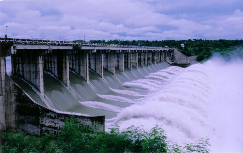
MARIS Dam in Nueva Ecija releases water (photo courtesy of NIA-Magat River Integrated Irrigation System)
Giving a dam(n)
PAGASA aims to manage the flooding risk caused by dams with its daily-updated products and services:
- Basin Daily Hydrological Forecast
- Flood bulletins
- General Flood Advisories (GFA) – Regional
- Status of Monitored Dams
Rosalie Pagulayan, a hydrologist at PAGASA, emphasizes the importance of risk management in harnessing the full potential of our dams. “Major dams are multipurpose,” she says. “They generate power, irrigate farms, provide potable water and controls flooding. During the rainy season, the dam stores excess water, keeping it from inundating the rivers and communities.” Angat Dam, in particular, provides 97% of Metro Manila’s water requirements, and irrigates 31,000 hectares of farmlands in Pampanga and Bulacan.
Though dams are meant to prevent flooding, extreme weather events that bring massive rains can force dam operators to conduct water releases.
But even the frequency of tropical cyclones in our country is a double-edged sword. “Many complain about the inconvenience of the rainy season, but upon studying our climate, a former PAGASA director was able to determine that 50% of our rain comes from tropical cyclones. If we don’t have tropical cyclones, our water supply suffers. Other weather systems are also important; the northwest and southwest monsoons bring 38% of our rain, while the ICTZ [intertropical convergence zone] brings 12%.” She adds that rains are important in crop irrigation and pushing out atmospheric pollution.
Pagulayan, who has been working in PAGASA for 15 years, says that there are protocols before spillways are opened. “Even before a typhoon comes, we predict how much rainfall it will bring. We give the data to the different dam offices, which compute the expected increase in water levels. To accommodate the incoming rain, the dams conduct pre-release—but only according to the river’s capacity to prevent flooding.” She adds that aside from measuring the amount of rain in the watershed, PAGASA also measure the rain’s impact. “There’s a warning post from dam offices before they release water. There’s ample lead time, so for example, if they’re opening the gates at 4 p.m., they warn residents as early as 10 a.m. so they can prepare.”
How flooding risks can be better managed
In other parts of the world, river systems span countries, such as the Brahmaputra River, which comes from India but flows downstream to Bangladesh. The famous Danube River also comes from several European regions. Such a situation calls for strong international coordination when the source of the river swells, and flows down to various countries and territories in low-lying areas.
But Pagulayan says this is not a problem in our country. “We are blessed with big river systems. We manage our own rivers, and solely benefit from them. Our rivers traverse through various municipalities, provinces and even regions.”
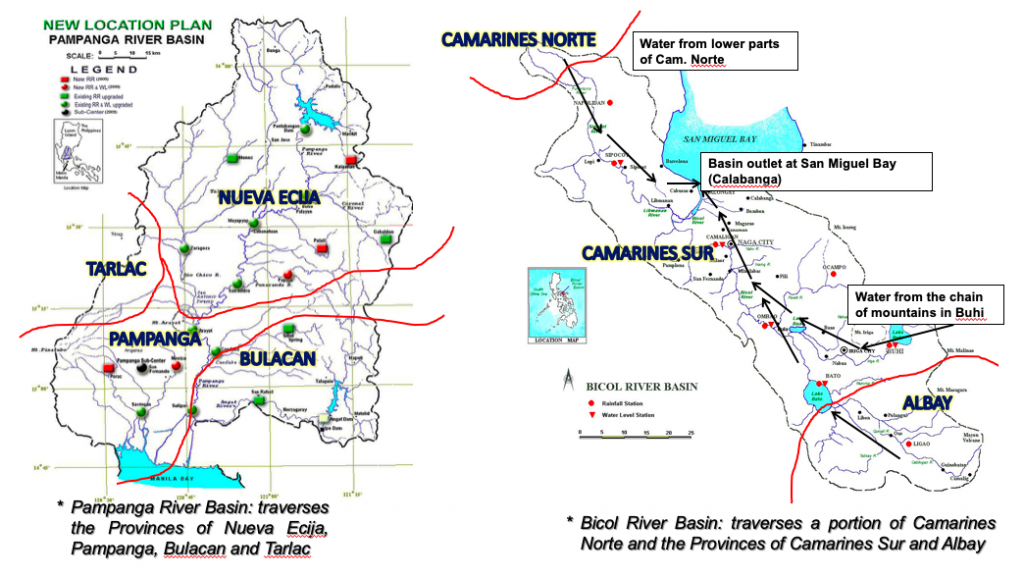
In the left graph above, Pagulayan shows how water from Nueva Ecija flows down to the Pampanga river basin, and contributes to a portion of Tarlac and Bulacan. “Our river systems encompass a lot of areas so disaster managers in these zones should be seamless in their communication and info-sharing.”
Meanwhile, as shown in the right graph above, water from the Bicol river basin comes from Albay, Camarines Norte, and mostly Camarines Sur. “But the Camarines Norte source is very important because rains are strong there, and because of its elevation, water flows down very fast,” shares Pagulayan. “All these rivers are owned by the Philippines. We don’t share them with other countries or regions. We are the only ones who can harness their potential.”
In areas that receive a lot of rain, dams and water reservoirs are built in mountainous areas, which can hold excess water. But watershed deforestation is an issue, leading to its decreased capacity for water storage. This may lead to flooding during the rainy season, and water supply shortage during the hot and dry season.
Risks also increase when people build their homes and livelihoods near waterways and flood plains. “They may find it convenient to set up livelihoods that require water, such as farms, in those areas, but once water is released, their safety is compromised,” explains Pagulayan. “Flooding also negates development efforts, and destroys agricultural products and infrastructure. But the worst risk of all is the loss of lives.”
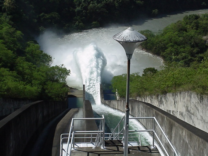
MARIS Dam’s spillway in Nueva Ecija (photo courtesy of NIA-Magat River Integrated Irrigation System)
Moving forward
To foster good relations with dam offices and local government units (LGU), PAGASA regularly conducts information and education campaigns, public information drives, and communication drills. “For every disaster, the challenge, I think, is communication, so this is what we constantly develop. We can’t stop; it has to be continuous so we can improve,” Pagulayan shares.
By practicing and strengthening the information flow from PAGASA down to the regional and municipal levels, data accuracy is ensured, allowing LGUs to map out action plans to lessen flooding impacts. “We learn from every experience how to convey data and information. We are open to change and we adjust our activities, so we can improve both our services and community action,” ends Pagulayan.
Communities can also mitigate risks by knowing what to do before a tropical cyclone arrives and causes flooding.
After the Quadrantids Meteor Shower last January 4, the skies will once again be illuminated by another major astronomical event—the Penumbral Lunar Eclipse.
Eclipses come in pairs
A solar eclipse is always paired with a lunar eclipse. A solar eclipse only happens during the new moon, while a lunar eclipse occurs during the full moon. For an eclipse to occur, the new and full moons have to take place within the eclipse season, wherein the Earth, Sun, and Moon are perfectly aligned. This happens twice a year, about six months apart.
What is a Penumbral Lunar Eclipse?
On January 11, 2020 at 1:07 a.m., the Penumbral Lunar Eclipse will be visible in the country. It occurs whenever the Earth passes between the Moon and the Sun, blocking out sunlight and casting a shadow on the Moon’s surface.
Unlike other types of eclipses, a Penumbral Lunar Eclipse is more subtle and much more difficult to observe. According to Fred Espenak, an American Astrophysicist, about 35% of all eclipses are penumbral. Another 30% are partial eclipses, while the remaining 35% are total eclipses of the moon.
Where will the Penumbral Eclipse be visible?
The eclipse will be visible in Africa, Oceania, Asia, Europe, and Northern America.
In Manila, the Penumbral Lunar Eclipse starts at 1:07 a.m., reaching its peak at 3:11 a.m. and ending at 5:12 a.m. The next eclipse for the year will be visible on June 6.
Can We Live on Mars?
Can other planets supporting life? Are we alone in this vast universe? These are some of the questions curious minds are interested in. And it’s this intense kind of curiosity that has led to one of our most ambitious space projects, the Mars Exploration.
Meet Mars
Mars is sometimes called the “Red Planet”. It’s red because its surface has iron oxide or rusty particles. Its only half size of Earth and like our planet, Mars has volcanoes, weather, seasons, polar ice caps and canyons. Its thin atmosphere is made of nitrogen, argon and carbon dioxide. These characteristics encouraged scientist to dig deeper into Mars’s history to find out if it once supported life – and maybe able to in the future.
The Mars Mission
So far, almost 50 spacecraft have visited Mars, but not all of them were successful in landing on its surface or in orbiting around the planet. Mars is the only planet scientists have sent rovers to –. These vehicles drive around the planet to take photos and measurements.
Scientists begun to send probes to the red planet in 1960. But Mars Exploration Program funded and led by the National Aeronautics and Space Administration (NASA), officially begun in 1994. The first six spacecraft all failed to reach Mars orbit.
Courtesy: NASA
Mariner 4 was the first successful flyby attempt that entered the planet’s orbit, arriving on July 14, 1965. This mission provided the first close up images of the planet.
The most recent successful landing on Mars happened just last November 2018. The Interior Exploration using Seismic Investigations, Geodesy and Heat Transport (InSight), is a robotic lander designed to study the deep interior of the planet and to listen to Marsquakes.
The Possibilities of Mars
Scientist are exploring Mars to determine if life ever arose on Mars, to characterize its climate and geology; and ultimately, to prepare for the human exploration of Mars. The Mars Exploration Program is a science driven program that seeks to understand whether Mars was, is, or can be, a habitable world.

Courtesy: NASA
Terraforming is the primary ingredient of the concept of Mars – colonization. This is a speculative course of alteration of the conditions of the planet to make it habitable for lives that are existing on Earth without any life supporting system.
In order to make Mars a habitable planet, Bruce Jakosky, a planetary scientist and principal investigator for NASA’s Atmosphere and Volatile Evolution and Christopher Edwards an assistant professor for planetary science, said that by using greenhouse gases that already present on Mars, we could, theoretically, raise temperature and change the atmosphere enough to make Mars an Earth – like.
Mars has exactly opposite problem as Earth. Mars as we all know is a cold planet, in fact the current climate on Mars is at average of about minus 81 degrees Fahrenheit (– 62.78°C), though the temperature can vary wildly. That is why scientists want to make Mars hotter and thicken its atmosphere, so its polar ice caps can melt. Considering more water means more opportunities for microbial life to do its work.
The idea of using microbes to begin a terraforming project on Mars is so encouraging that NASA has already begun initial tests. The Mars Ecopoiesis Test Bed is proposed for development to be included with future robotic mission to Mars. This is something look like a drill with hollow chamber inside with container full of cyanobacteria. The drill would bury itself in the Martian soil, preferably in a place with the presence of liquid water and then the container with cyanobacteria would be release into the chamber and the built – in biosensor would detect whether the microbial life produce any oxygen or other bvproducts.
The first phase of this project was conducted in a simulated Martian environment here on Earth, and the results were promising. But even still, there are some major challenges we’ll have to face if ever we want to use microbially terraform Mars on a large-scale.
Conclusion
We are clearly excited about what the future may bring. Pushing ahead, trying to understand what Mars may have for us. Uncertain of what the outcome may be, but McKay once said, “Life may not be scientifically preferred explanation, but it cannot be yet disproven”.
By: May Dacula, PanahonTV Intern
Sources:
https://history.nasa.gov/marschro.htm
https://science.nasa.gov/solar-system/programs/mars-exploration
https://bigthink.com/surprising-science/using-bacteria-to-terraform-mars
“The moon is a loyal companion. It never leaves. It’s always there, watching, steadfast, knowing us in our light and dark moments, changing forever just as we do. Every day it’s a different version of itself. Sometimes weak and wan, sometimes strong and full of light. The moon understands what it means to be human. Uncertain. Alone. Cratered by imperfections.”
– Tahereh Mafi
Nights aren’t not complete without the presence of the moon. Let’s get to know our nocturnal friend better with these fun facts:
1. It’s smaller than the Earth.
The National Aeronautics and Space Administration (NASA) says that the radius of approximately 1,737.5 kilometers. If the Earth were the size of a nickel, the moon would just be as big as a coffee bean.
NASA added that around 30 Earth-sized planets could fit in the distance between our planet and the moon, which is 384,400 kilometers away.
2. You can’t live on the moon.
According to NASA, the moon has a very thin and weak atmosphere, which doesn’t protect it from the sun’s radiation or impacts of meteoroids. This is also the reason why temperatures on the moon are extreme, ranging from boiling hot to freezing cold depending on the orientation of the sun.
Astronauts who explored the moon were equipped with spacesuits that had several layers of insulation and equipped with internal heaters and cooling systems.
3. The moon is responsible for the rising and falling of ocean tides.
Around each new and full moon, the pull on the tides increases due to the gravity of the sun that reinforces the moon’s gravity. During these phases, the tides are at their maximum.
Meanwhile, during the first quarter and last quarter phase, the sun’s gravity works against the gravity of the moon. This is when the tide’s range is at its minimum.
4. There may be earthquakes on the moon!
NASA confirmed that the moon may be seismically active. This is based on data gathered between 1969 to 1972, when Apollo astronauts placed seismometers at their landing sites on the moon.
Because the moon is dry, cool and mostly rigid, moonquakes are continuous unlike earthquakes that usually last for half a minute.
5. The moon has its own festival.
The Moon Festival is a holiday in China and several Asian countries. It’s one of the most important celebrations in the Chinese calendar, traditionally held when the moon is at its fullest and roundest.
This event gathers families and friends that admire the bright mid-autumn moon and eat moon cakes. Moon cake is a sweet pastry with red bean or lotus-seed filling. It is believed to be the symbol of completeness and unity among families.
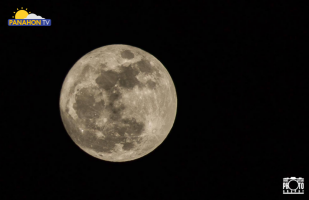
Photo by: Bobs Artajo, one of the Top20 Supermoon Photo Contest winners
6. The full moon has a different name each month.
The names of the Full Moon originated from the Algonquin tribes of Native America which was adapted by some of the Colonial Americans.
January – Full Wolf Moon
It is believed that this full moon appeared when wolves howled in hunger.
February – Full Snow Moon
Usually the heaviest snow falls in February, making hunting difficult.
March – Full Worm Moon
During spring, the ground softens and earthworm casts reappear. Also known as the Sap Moon, it marks the time when maple sap begins to flow and the annual tapping of maple trees begins.
April – Full Pink Moon
This full moon signaled the appearance of the moss pink or wild ground phlox, one of the first spring flowers.
May – Full Flower Moon
Flowers become abundant during this month.
June – Full Strawberry Moon
The Algonquin tribes consider this moon as a sign of the perfect time to gather ripening strawberries. It is sometimes called as the Rose Moon.
July – Full Buck Moon
During this time, the antlers of bucks are in full-growth mode.
August – Full Sturgeon Moon
Some Native American tribes knew that the sturgeon, or a type of fish that lives in the northern part of the world, was mostly caught during this full moon.
September – Full Corn Moon
This corresponds with the time of harvesting corn.
October – Full Hunter’s Moon
This is the time for hunting as preparation for the long winter ahead.
November – Full Beaver Moon
This is the time when beavers actively build their winter dams in preparation for the cold season.
December – Full Cold Moon
This is the month when the winter cold speeds up.
7. The moon doesn’t have its own light.
The moon merely reflects light from the sun. The light that we see from the moon is an illusion of the reflected light.
Astronomers say it will take hundreds of thousands of moons to get the same brightness of the sun. Even when a moon reaches its full phase, it always shines with a lower magnitude that the sun.
8. The US first conquered the moon.
According to NASA, there were three men who first stepped in the moon. Neil Armstrong, Edwin Aldrin and Michael Collins were the astronauts on the successful Apollo 11 mission in 1969. Armstrong and Aldrin landed on the moon while Collins stayed in orbit around the moon, doing experiments and taking images.
On July 20, 1969, Neil Armstrong became the first human to step on the moon. He and Aldrin were able to walk around the moon for a few hours, picking up bits of dirt and rocks for experiments. They also installed a U.S. flag on the moon.
9. The moon has inspired idioms!
“Once in a blue moon” refers to an even that is rare, seldom or surreal. Blue Moon refers to the second full moon in a month. Normally, there is one full moon each month but there are also rare instances that a second one sneaks in.
This doesn’t literally mean that the moon turns into a bluish color. However, it is believed that during the 1883 Krakatoa Volcano explosion in Indonesia, people noticed that the moon turned blue. Scientists explained that this phenomenon was more likely because of the ash clouds that rose to the top of the Earth’s atmosphere.
10. Some people love staring at the moon!
If you are fond of staring at the moon, you may be a “selenophile” or a person who loves the moon. “Selene” is the Greek name for the Goddess of the Moon while the suffix “phile” comes from the Greek “philos” which means “loving”.
Sources:
National Aeronautics and Space Administration (NASA)
http://www.moonconnection.com
https://www.space.com
http://earthsky.org
http://aa.usno.navy.mil
http://seismo.berkeley.edu/blog/2009/07/20/quakes-on-the-moon.html
PAGASA continues to monitor two weather disturbances.
At 3:00 a.m., the LPA inside the Philippine Area of Responsibility (PAR) was spotted at 410 kilometers east-northeast of Hinatuan, Surigado del Sur. However, it has a slim chance of developing into a Tropical Cyclone. Meanwhile, another LPA is being monitored outside PAR. In an interview with PAGASA Chris Perez, he said that the other weather disturbance was located east of Mindanao. It may enter PAR this weekend and bring rains in Southern Luzon, Visayas and Mindanao next week. It may also develop into a Tropical Cyclone.
With the presence of Amihan, Cagayan Valley Region and Cordillera Administrative Region will have cloudy skies with scattered rains. Today, the rest of Luzon, including Metro Manila, can enjoy partly cloudy to cloudy skies with isolated rains. Residents of Visayas and Mindanao can also look forward to partly cloudy to cloudy skies with possibilities of isolated rain showers or localized thunderstorms.
Gale warning is still in effect in the northern and eastern seaboards of Northern Luzon. These include coasts of Batanes, Babuyan Group of Islands, Ilocos Norte, Cagayan and Isabela. Fishing boats and other small seacraft are prohibited from venturing, while larger sea vessels are alerted against rough to very rough seas.
Did you know that the lowest temperature in Baguio City dropped to 9.6 degrees Celsius yesterday? Below are areas that experienced the coldest morning yesterday:

Hanging Amihan or the Northeast Monsoon, still at its peak, is now affecting the entire archipelago. Characterized by cold and dry air coming from Mainland China or Siberia, it usually starts to affect the country during the ber months and peaks in January and February, where temperatures start to fall.
Apart from cold weather, it may also bring rains in some parts of the country including the regions of Cagayan Valley, Cordillera, Bicol, Eastern Visayas and Caraga, where cloudy skies with light rains are expected.
The same weather condition will prevail in the provinces of Aurora, Quezon, Davao Oriental and Compostela Valley. The rest of the country will experience partly cloudy to cloudy skies with isolated light rains.
Meanwhile, the strong surge of Amihan will also trigger rough to very rough seas, making it risky for fishing boats and other small seacraft to venture out today. The following areas are under gale warning:

In an interview with Panahon TV, PAGASA Weather Forecaster Gener Quitlong said no weather disturbance is expected to affect the country in the next two to three days. “Kaya po masyadong mababa ang tyansa na may nabubuong bagyo kapag buwan ng Pebrero, unang-una ang February iyan po ang pinakang-peak ng Amihan.
So ibig sabihin po niyan, malamig ang panahon at naaapektuhan nito ang dagat. Iyan po ang pinaakaayaw ng bagyo. Kadalasan Low Pressure Area lamang ang nabubuo at mabilis po itong malusaw.” (During February, there is a lower chance for tropical cyclones to form within our premises due to the peak of Amihan. The cold and dry characteristics of Amihan are not favorable for weather disturbances.)
Don’t miss our episodes, catch the replay of our interview earlier this morning: