Home > Blog > Weather Today
Weather Today – October 14, 2015 |Tropical Storm to enter PAR today
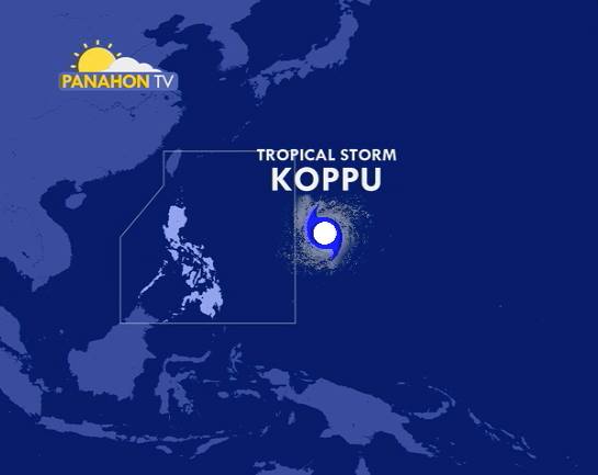

As it traverses the ocean, the Tropical Depression outside the Philippine Area of Responsibility (PAR) has gained strength and intensified into a Tropical Storm. Now called by its international name “Koppu”, it was last located at approximately 1,515 kilometers east of Luzon. It has maximum sustained winds of 65 kilometers per hour and gustiness of up to 80 kilometers per hour.
Koppu is expected to move west at 22 kilometers per hour. PAGASA Weather Forecaster Samuel Duran says that if it maintains current velocity, it could enter the PAR this afternoon and will be given the local name “Lando”.
Meanwhile, the Northeast Monsoon prevails over the PAR, particularly affecting Northern Luzon. Locally known as “amihan”, it is composed of northeasterly winds that are cold and dry in nature. These winds reach the PAR as the high pressure systems over the mainland China or Siberia intensify. The Northeast Monsoon usually begins during the 1st or 2nd week of October, while it peaks by January or February.
Due to its present direction, Duran says the possibility of the Tropical Storm making landfall over the northern part of Luzon remains high. The surge of the Northeast Monsoon or amihan also affects the movement and intensity of the storm. The cold and dry characteristics of amihan are not favorable to the intensification of a Tropical Cyclone. Meanwhile, it could also affect its path–instead of moving northward, it may move west because of the amihan’s presence.
Today, the Tropical Storm has no direct effect yet to any part of the country. However, amihan will bring cloudy skies with light rains over Cordillera and Ilocos Region, while Cagayan Valley, Bicol Region and the provinces of Aurora, Quezon and Samar will have light to moderate rains and isolated thunderstorms. The rest of the country, including Metro Manila, will experience partly cloudy to cloudy skies, still with chances of isolated thunderstorms.

Due to the winds associated with the Northeast Monsoon, gale warning is up over the seaboards of Northern Luzon and the eastern seaboard of Central Luzon. These include Batanes, Calayan, Babuyan, Northern coast of Cagayan, Ilocos Norte, Ilocos Sur, La Union, Pangasinan, Isabela, east of Cagayan and Aurora. Winds of 52 to 63 kilometers per hour may be experienced, with wave height ranging from 3.4 to 4.5 meters. Sea travel is risky for small fishing boats and other small seacraft, while larger sea vessels are alerted against big waves.
Latest Advisories
